PRODUCT
Aerobo Marker(AS-GM01)
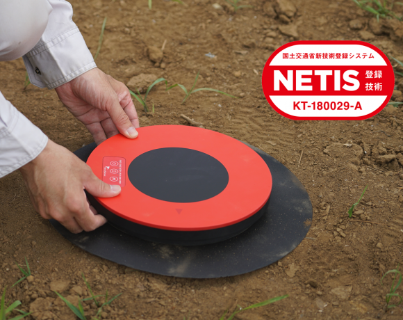
The Aerobomarker (AS-GM01) is an anti-aircraft marker for drone surveying with a built-in GNSS receiver. It can be used not only as an anti-aircraft marker, but also as a surveying instrument for reference point surveying.
AS-GM01
High-precision GNSS receiver built-in ground control point
Aerobo Marker(AS-GM01)
Automatic acquisition of location information of the installation site with simple operation.
Ground control point with built-in GNSS receiver that can also be used as a surveying instrument
Aerobo Marker is a ground control point that can measure the marker's position (GNSS static positioning method) while taking aerial photographs, helps to the reduction of field work time.
FEATURES
Main features of the Aerobo Marker
1
GNSS receiver built-in ground control point
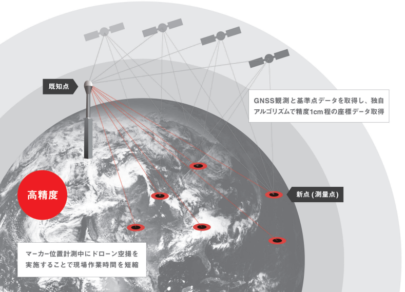
Can be used as a ground control point in drone photogrammetry. Multiple points can be measured simultaneously while taking aerial photographs, reducing the working hours required for field work.
In addition, markers are automatically detected from images by functions optimized for image processing, significantly reducing image processing time.
*Aerobo Cloud is used for automatic marker detection.
2
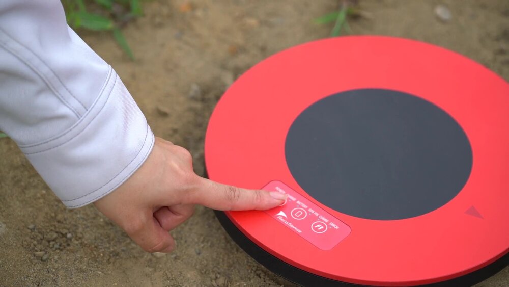
Press only one time to operate
No complicated initial setup or technical knowledge is required. After placed the marker, just by turning on the power, the system acquires location information of the installation site and starts recording. There is no need to measure coordinate positions as with conventional ground control point.
After the operation, simply connect the marker to your PC with a USB cable to retrieve the measurement log.
3
GNSS positioning accuracy is approximately 1cm
The highest accuracy GNSS positioning methods, including RTK positioning are included. It uses GNSS radio wave information from a known point and two new points (observation points) to achieve a baseline length accuracy of 1 cm (static positioning*).
*Using Aerobo Cloud
4
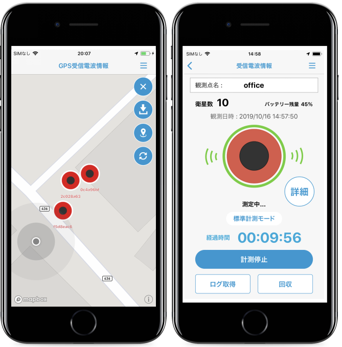
Linked to mobile apps
The Marker Navi iOS application allows you to check the observation status of the Aerobo Marker, especially the GPS satellite signal strength, in the field, which is important for achieving highly accurate positioning.
*Marker Navi requires the firmware version 2.2.2 or higher of the Aerobo Marker. Please check the version of the firmware on the marker itself, and download the firmware file from this download link and update the firmware according to the attached instruction manual for the marker with the above version or earlier.
*
5
Can be used as surveying instruments for reference point surveying
Aerobo Marker and Aerobo Cloud can be used as surveying instruments as they are approved as Class 2 GNSS surveying instruments in the GSI Basic Surveying Model Register.
By attaching the dedicated adapter to the Aerobo Marker and setting it on a tripod and leveling table, a reference point can be measured with the Aerobo Marker.
This is available for all reference point surveys, including basic surveys, and Aerobo Cloud outputs forms that comply with public surveying standards.
SPECIFICATIONS
Product Specifications
The Aerobo Marker is a ground control point with a built-in GPS receiver. Simply placing the marker at a fixed point or verification point enables automatic and highly accurate measurement. Simultaneous measurements can be made while taking aerial photographs of multiple fixed points, thus improving work efficiency.
The GNSS receiver is certified as a Class 2 GNSS surveying instrument for static positioning and can be certified as a GNSS surveying instrument with performance classification by surveying instrument class (equivalent to the observation accuracy of the 1-frequency static method and the shortened static method) in accordance with the rules of public surveying work regulations.
| Dimentions | External dimensions (overall) Φ350 mm x 37 mm External dimensions (main body) Φ240mm x 30mm |
|---|---|
| Main unit weight (1 unit) | 474g |
| Performance | Dust and waterproof rating: IP65 Static positioning accuracy*: H: 10 mm + 1 ppm x D* RMS*, V: 10 mm + 2 ppm x D RMS *Positioning accuracy: accuracy and reliability depend on a variety of anomalous conditions, such as multipath, surrounding obstacles, GNSS satellite placement, atmospheric conditions, etc. *D: baseline length *RMS: Root mean square. A measure of the deviation of observed values. |
| Environment standard | RoHS compliant |
| Satellites |
GPS(L1) GLONASS(L1) QZSS(L1C/A) |
| Interface | USB 2.0 TypeB (for charging and data downloading) Bluetooth 4.0 (BLT) |
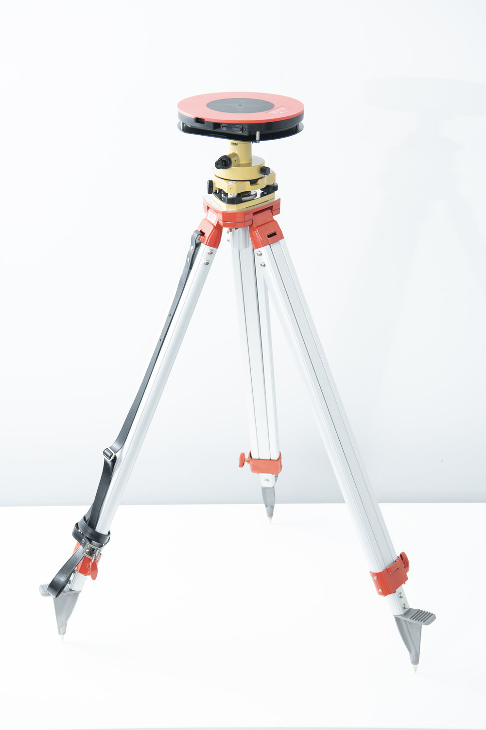
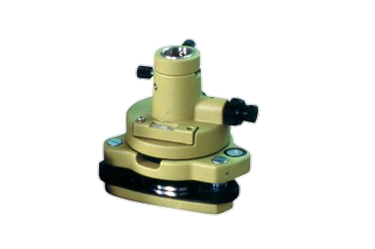
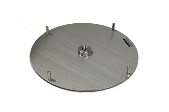
Optional items
Optional products are available for more convenient use of Aerobo Marker.
Leveling table
Tripod adapter
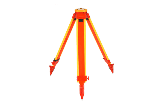
Wooden tripod
Feel free to contact us regarding the made-in-Japan industrial drones.
E-mail newsletter subscription
We will send you the latest case studies, product information, and proposals for problem solutions for IoT solutions utilizing drones via E-mail newsletter.
Learn more
about drones
Download product catalogs for drones and peripheral equipments.
Free Consultation for drone purchasing, business requirements
We accept a wide range of consultations, from drone purchasing to business requirements.