DRONES
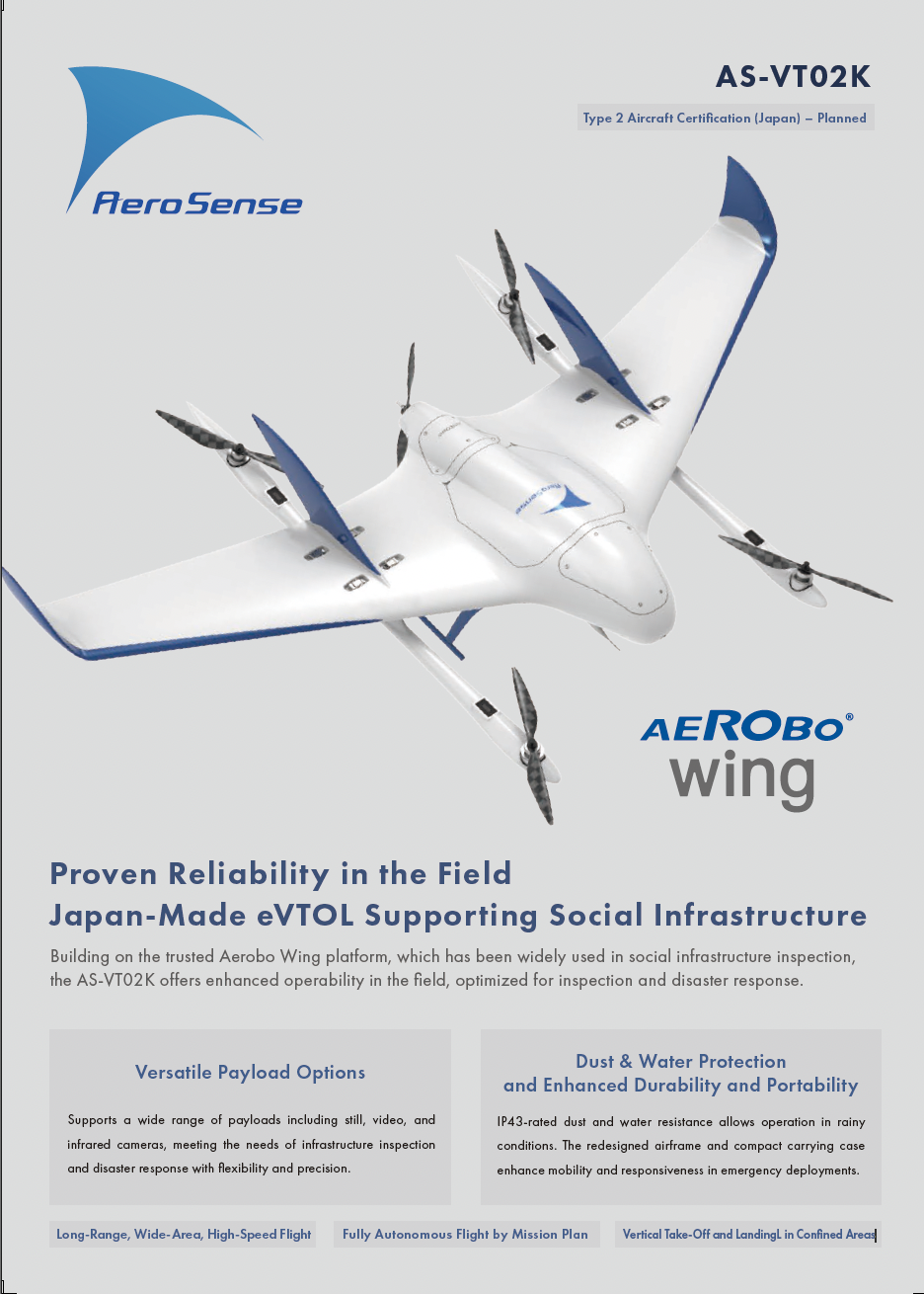
Introducing the Aerobo Wing (AS-VT02K), a fixed-wing vertical takeoff and landing aircraft (VTOL) ideal for wide-area and long-distance flights. Depending on the application scenario, the optimal payload can be selected, such as a laser scanner or a thermal imaging camera.
AS-VT02K
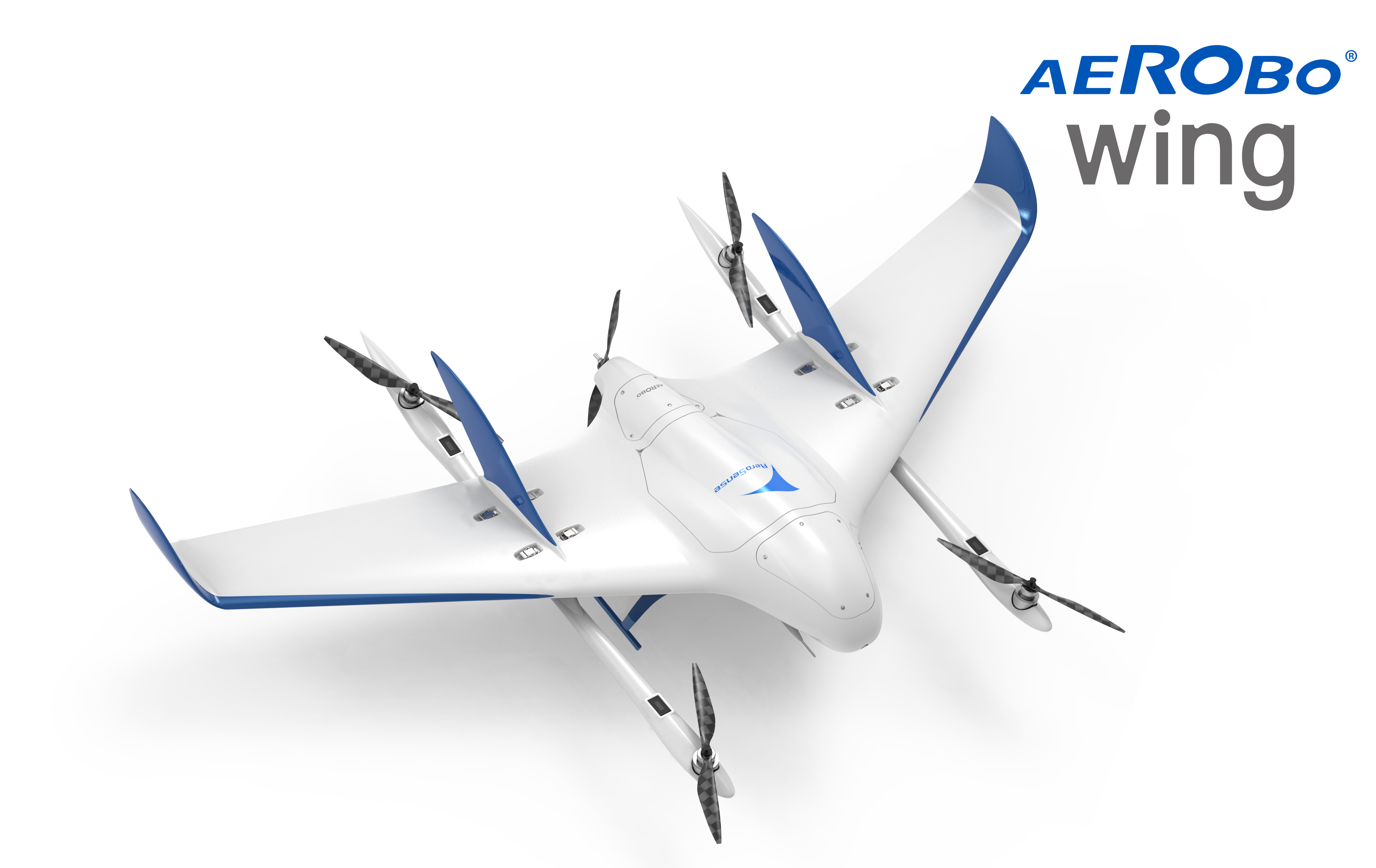
A multi-purpose VTOL drone designed for long-distance inspections, patrols, surveys, and other wide-area operations.
Building on the trusted Aerobo Wing platform, which has been widely used in social infrastructure inspection,
the AS-VT02K offers enhanced operability in the field, optimized for inspection and disaster response.
FEATURES
Main Features of Aerobo Wing
Long-Range, Wide-Area, High-Speed Flight | Fully Autonomous Flight by Mission Plan | Vertical Take-Off and Landing in Confined Areas
Versatile Payload Options
Supports a wide range of payloads including still, video, and infrared cameras, meeting the needs of infrastructure inspection and disaster response with flexibility and precision.
Dust and Water Protection and Improved Transportability
The AS-VT02K features an IP43-rated airframe that provides protection against solid objects and water spray. Its redesigned airframe and carrying cases are designed for easier transportation and deployment at inspection and emergency response sites.
AS-VT02K
| Model | AS-VT02K |
|---|---|
| Dimensions | 2.1 × 1.2 × 0.4 m (excluding propellers) |
| Aircraft Weight | 9.4 kg (including batteries) |
| Maximum Takeoff Weight | 11.0 kg |
| Maximum Payload Capacity | 1.6 kg |
| Power Supply | 2 × 6S 13,000 mAh solid-state lithium-polymer batteries |
| Flight Time | Up to 70 minutes * |
| Flight Range | Up to 80km * |
| Maximum Speed | 100km/h |
| Cruising Speed | 70 km/h |
| Maximum Wind Resistance | 10m/s ** |
| Operating Temperature | -10 ℃~40℃ (excluding batteries) |
| GNSS | Dual-frequency GNSS (GPS, GLONASS, Galileo, BeiDou, QZSS / L1, L2) |
| Navigation Cameras | 2 cameras installed (front-facing / downward-facing) |
| Dust and Water Protection | IP43 |
| Safety |
|
| Sensors | IMU, downward radar ranging sensor, heated airspeed sensor, barometric pressure sensor |
| Pre-Flight Inspection Function | Automatic check of sensors and actuators |
| Flight Controller | Aerosense Flight Controller |
| GCS | Aerosense “Aerobo Station” |
| Flight Control | Automatic navigation based on flight plans |
| Aircraft Control Radio | 2.4 GHz band, LTE, SRS radio (optional), 5.7 GHz band (optional) |
| 2.4 GHz Radio Communication Range | Line-of-sight 1,500 m (standard version) Line-of-sight 5,000 m (high-power version) |
| LTE Communication Module | Built-in |
| Data Storage | SD card for video recording from navigation cameras when UMC-R10C is not installed |
| Carrying Case Size | 1) 1.1 m × 0.9 m × 0.5 m (including protrusions) 2) 1.3 m × 0.3 m × 0.3 m (including protrusions) |
| Certification | Class 2 UAS Type Certification (Japan) – Pending |
| Country of Manufacture | Japan |
MORE INFORMATION
This is the catalog for the Japanese eVTOL drone Aerobo Wing (AS-VT02K), developed with a strong focus on enhancing on-site operability.
Click here to download the documents.
Download product catalogs for drones and catalogs for peripheral equipment and systems.
If you are considering introduction
or would like a free consultation, click here.
We accept a wide range of consultations related to the introduction of drones, from concerns about drone utilization to specific product considerations. Please feel free to contact us using the form on this website.
We will send you the latest case studies, product information, and proposals for problem solutions for IoT solutions utilizing drones via E-mail newsletter.
Download product catalogs for drones and peripheral equipments.
We accept a wide range of consultations, from drone purchasing to business requirements.