Aerobo Cloud
Ultra-fast image analysis and processing cloud software
Aerobo Cloud is a data processing service for drone operations. It supports drone operations such as surveying and inspection to improve efficiency.
SERVICE
Aerobo Cloud provides an application on the cloud that manages, processes, and analyzes data related to drones and images taken.
By using Aerobo Cloud, you can operate from uploading images to processing data for surveying using only a web browser, without installing any special software on your PC.
In addition, Aerobo Cloud provides high-speed processing and automation using cloud technology to improve the efficiency of your operations.
1
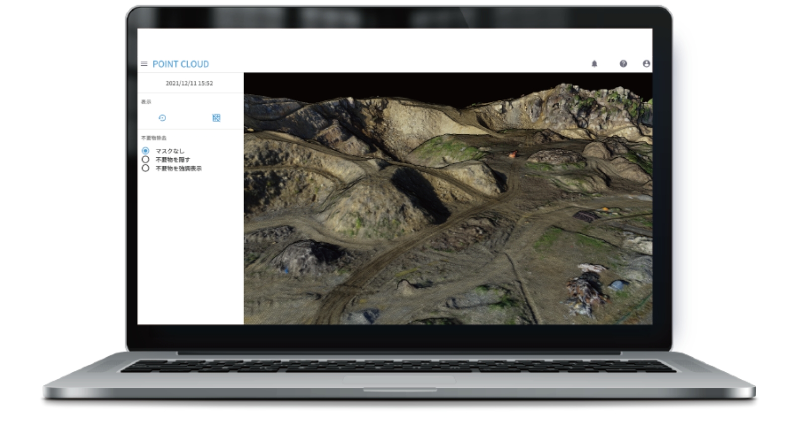
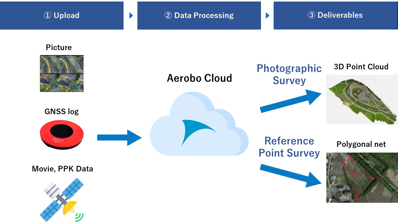
Aerobo Cloud is a cloud application that enables processing and analysis based on GNSS logs and aerial images with a few simple operations.
The drone surveying service can generate orthoimages and 3D models from aerial images that can be used for i-Construction operations.
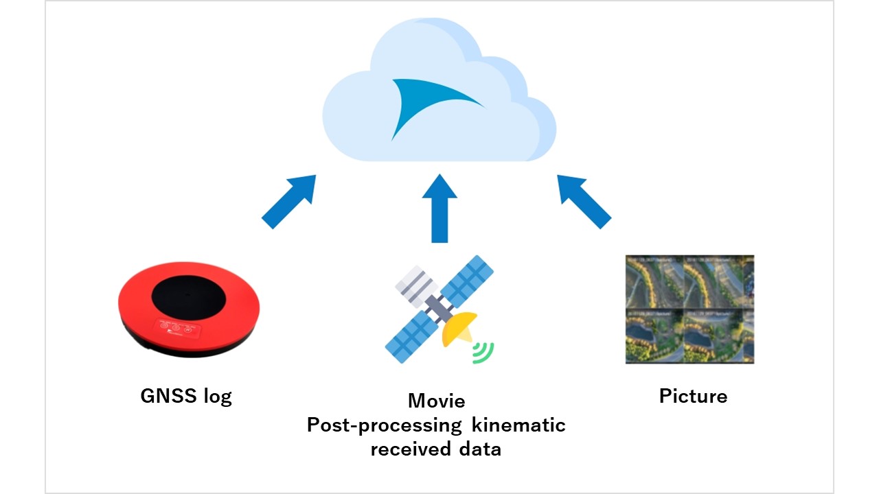
The reference point surveying service performs positioning and baseline analysis necessary for reference point surveying from GPS satellite logs received by GNSS, and outputs the data required for construction and civil engineering work.
2
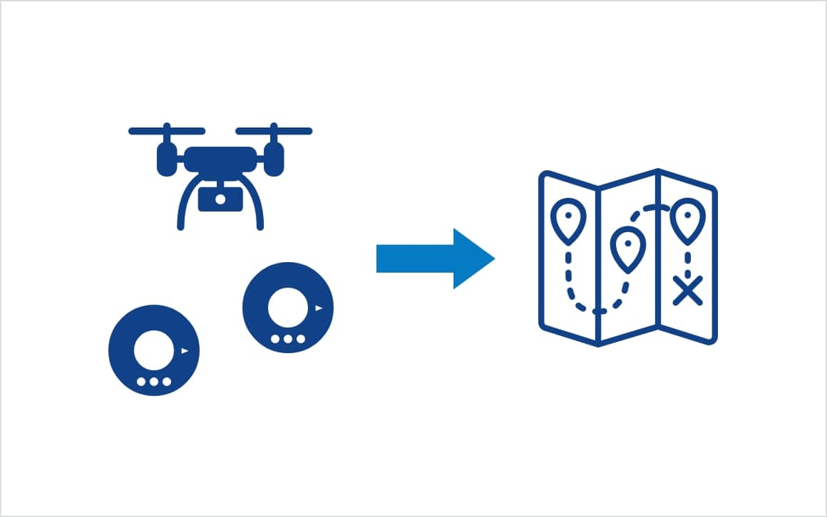
By simply uploading the logs of GPS built-in ground control point, such as the "Aerobo Marker", it can be automatically detected from aerial images and automatically matched with GPS coordinates. This enables automatic positioning processing without inputting positioning results or selecting marker positions in the image.
3
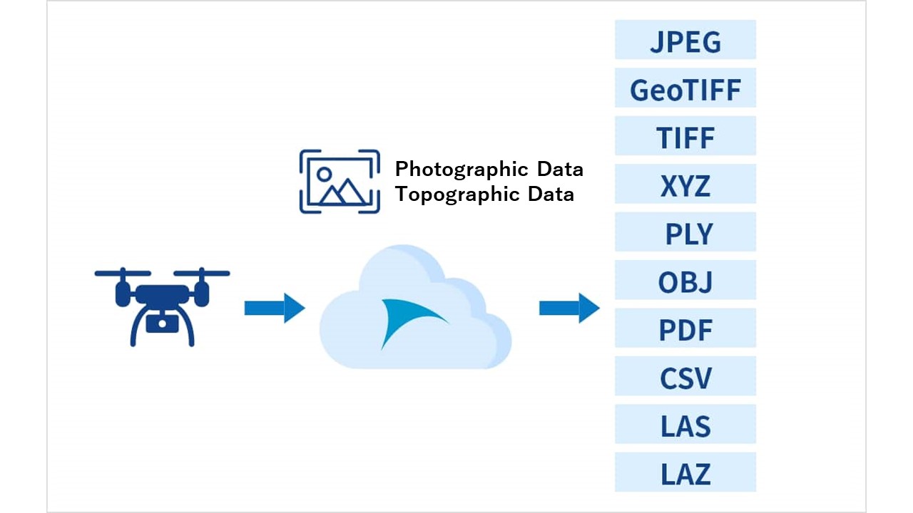
Data captured by drones and topographic data can be managed in the cloud service. Generated data can be displayed on maps and output in any formats.
All data is stored in the cloud, making it easy to view results and download various types of data at anywhere.
MERIT
Advantage 1
Since the system runs on a web browser, it can be used anytime, anywhere.
Multiple people can view the same screen, making it easy to share analysis results.
Advantage 2
A high-performance machine with an expensive graphics board is not required. Moreover, processing is faster than on a local machine.
Advantage 3
In addition to Aerosense’s drones and Aerobo Markers, it can also process DJI drone imagery and general surveying ground control point.
Compatible with other drones than made by Aerosense.
Aerobo Cloud's processing speed is one of the fastest in the industry. It reduces the waiting time for analysis processing of photo images, polygonal network calculation, etc.
Large-scale point clouds can be displayed on a web browser using our unique point cloud image processing. Unnecessary objects such as heavy machinery and buildings are automatically removed. Simple calculations of "length," "angle," "volume," etc. can be performed on the point cloud.
AI can automate data input that used to be done manually. 3D point cloud surveying and reference point surveying calculations can be easily performed.
Combined with Aerobo Marker, multiple on-site reference points can be calculated at once.
Linkage with Fukui Computer's "TrendPoint" point cloud processing software. In addition, data can be easily shared with the Fukui Computer's cloud CIMPHONY Plus.
We provide a stable data processing environment even for large images. Data can be viewed, shared, and managed smoothly using only a browser. No need to prepare a high-performance PC.
Drone survey calculation supports a wide variety of formats. (JPEG, GeoTIFF, TIFF, XYZ, PLY, OBJ, PDF, CSV, LAS, LAZ, etc.) Standard forms are supported for reference point surveying.
Post-processing kinematic enables easy generation of highly accurate topographic data. This can greatly improve work in locations where marker placement is difficult (e.g., elevation differences, bad radio reception, etc.).
DATA PROCESSING WORKFLOW
We will send you the latest case studies, product information, and proposals for problem solutions for IoT solutions utilizing drones via E-mail newsletter.
Download product catalogs for drones and peripheral equipments.
We accept a wide range of consultations, from drone purchasing to business requirements.